Recent Updates
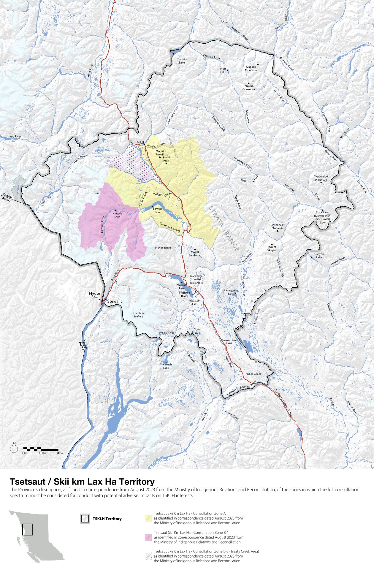
The Tsetsaut Skii km Lax Ha Nation's traditional territory encompasses parts of the Nass River, Skeena River, Bear River, and Stikine River watersheds in northwestern British Columbia. Tsetsaut Skii km Lax Ha territorial boundaries are depicted on the two maps on this page.
BC Government Recognition of TSKLH Territory
The Tsetsaut Skii km Lax Ha Nation continues to work with the BC government to advance the Province's understanding of the Tsetsaut Skii km Lax Ha Nation and TSKLH Territory.
As of 2023, the Province established a zoned approach to consultation with the Tsetsaut Skii km Lax Ha Nation, identifying several zones of consultation1:
- Zone A (based on Delgamuukw map boundaries)
- Zones B1 and B2 (additional areas including the Treaty Creek Valley area)
- Zone C
For Zones A, B1, and B2, the Province indicated it will "consider the full range of the consultation spectrum."1 The provincial consultation zones, updated as of August 2023, are depicted on the map to the left.
Click on the map for a pop-up version that will allow you to zoom in.
Current Status
The BC government's position is guided by:
- The Province's 2021 Ethnohistoric Report titled "Tsetsaut Skii km Lax Ha: Review of Ethnographic and Historical Sources"2
- Historical documentation and evidence
- Ongoing consultation processes
- Updated territorial assessments
The Province's recognition has grown to acknowledge that "all evidence suggests" certain areas, such as the Treaty Creek Valley and surrounding area, are part of TSKLH Territory, requiring the highest levels of consultation for any development activities in these areas.1
The Province's recognition has evolved considerably over the past several years and the Tsetsaut Skii km Lax Ha Nation continues to work diligently to ensure ultimate recognition of its Rights and Title to the entirety of TSKLH Territory.